

FLOODING has hit the Malvern Hills area with water levels still set to peak across the county.
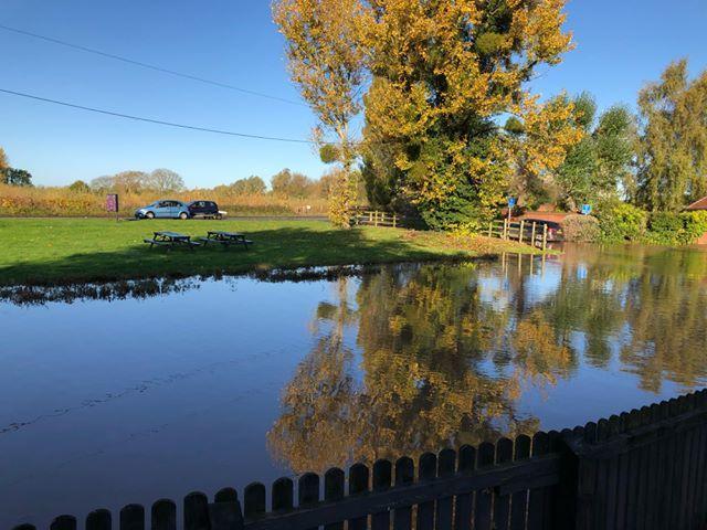
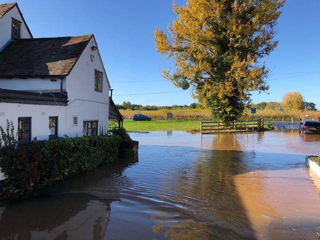
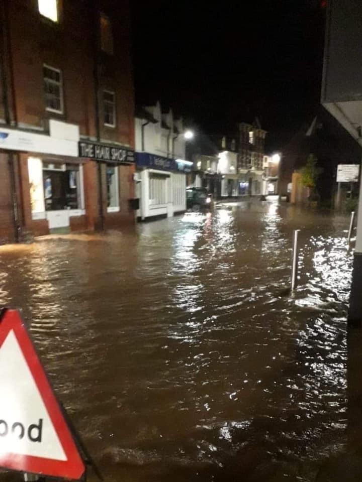
Our readers have captured stunning pictures of flooding across the region after this weekend's heavy rain.
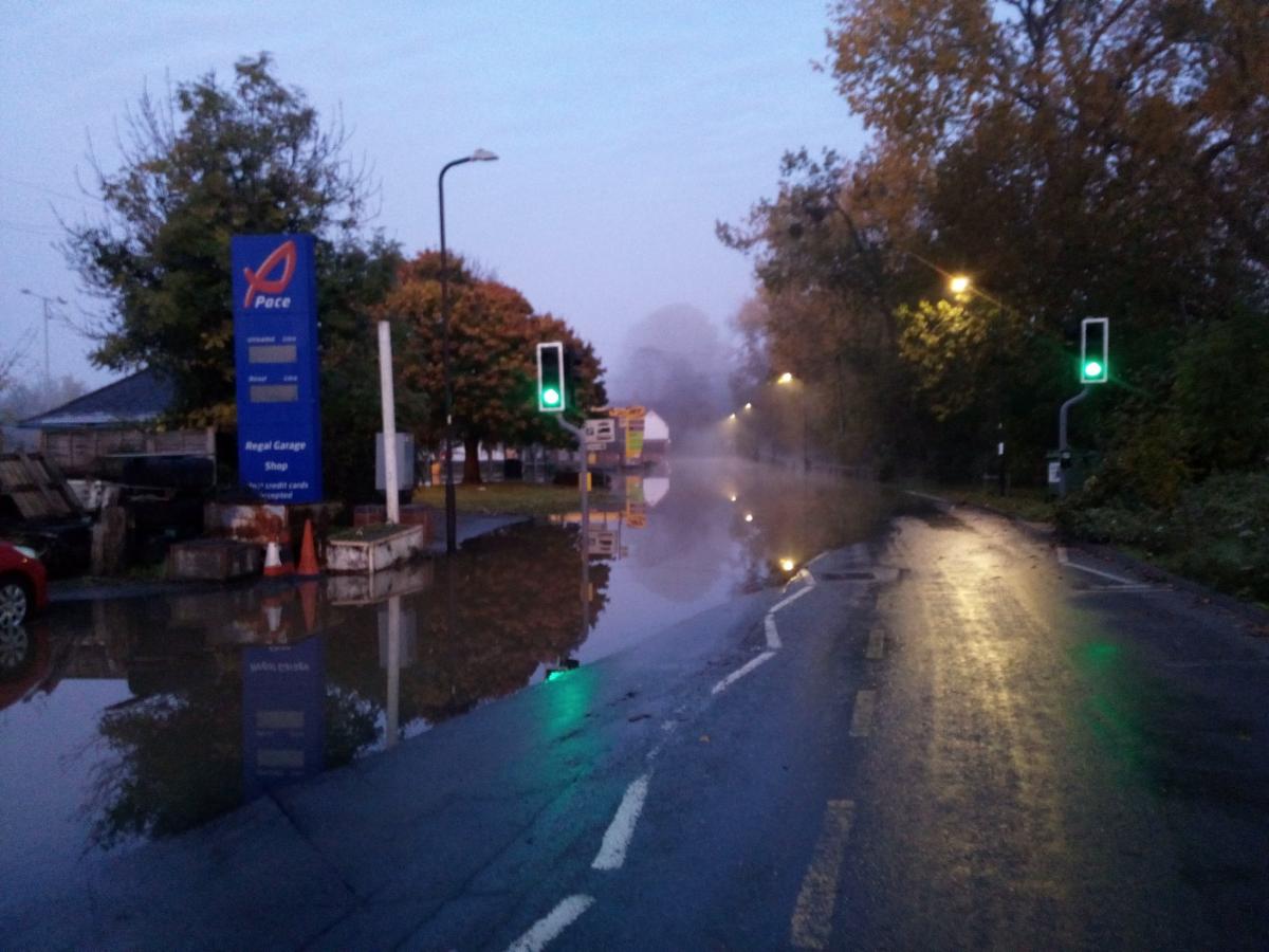
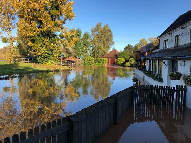
The Fox Inn at Bransford has been hit by the floods, with several roads across the region still closed.
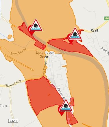
Water levels in Upton Upton Severn are also continuing to rise with the main road out of the town still closed and water levels rising.
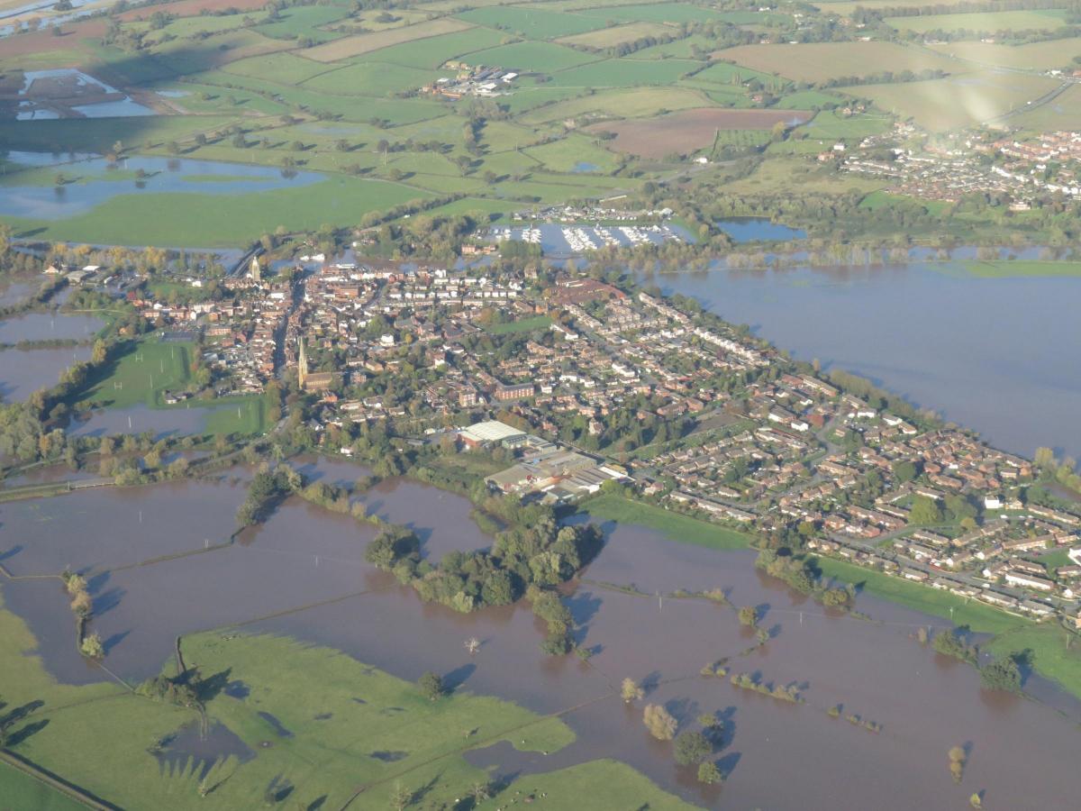
Stunning aerial photos show the town surrounded by flooded land all around as the River Severn burst its banks over the weekend.
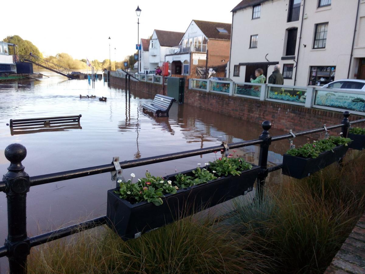
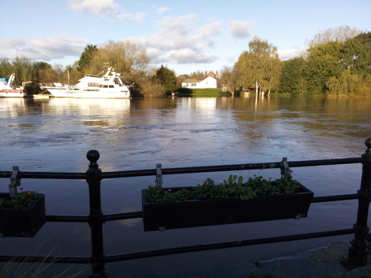
New Street in the town and the B4211 Hanley Road have both been closed since Sunday and the waterfront remains submerged.
Upton's deputy town clerk Clara Clements confirmed that the Hanley Road and New Street were both still closed on Monday morning, and that the water levels are expected to peak on Tuesday morning at 5.3 metres.
Flood warnings remain in place for East Waterside, Hanley Castle and Saxon Lode and Hanley Road.
The river level gauge at Saxons Lode stood at 5.15 metres while the typical level recorded is around 3.5 metres.
The highest reading recorded at Saxons Lode is 5.925 metres, recorded in July 2007.
The most recent highest level recorded was in February 2014, when the level stood at 5.446 metres.
The lowest reading recorded at Saxons Lode came in August 1976, when the water level stood at just 0.322 metres.
The main road from Worcester to Upton was reduced to one lane after flooding, with the A449 at Powick reduced to one lane because of flood water.
We will publish more updates on the situation in Upton as we get them.


Comments: Our rules
We want our comments to be a lively and valuable part of our community - a place where readers can debate and engage with the most important local issues. The ability to comment on our stories is a privilege, not a right, however, and that privilege may be withdrawn if it is abused or misused.
Please report any comments that break our rules.
Read the rules hereLast Updated:
Report this comment Cancel